Protected areas (PAs) are critical for conservation of species and ecosystems. Since 1990, global terrestrial area designated as PAs has increased more than 50% (Juffe-Bignoli et al., 2014). While PAs are often criticized for negatively impacting the livelihoods of marginalized rural communities, contrasting dynamics have emerged outside PAs. Increasing employment opportunities, resource availability, and improved market access in PA buffers have led to higher rates of population growth in these areas compared to other rural areas (Wittemyer et al., 2008). As human populations expand and encroach upon natural habitats, many animal species face increasing competition with people for resources and space, often resulting in habitat loss and degradation. The effectiveness of PAs is also impacted by what takes place outside their boundaries (Hansen and DeFries, 2007). Species such as wildebeest (Connochaetes taurinus) use areas outside reserves for their annual migration, while African elephants (Loxodonta africana) range widely and routinely leave protected areas. Agricultural conversion and urban expansion disrupt the wildlife corridors and restrict animal populations within PAs. As a result, some species, such as the African elephant, are coming into increasing conflict with people. Human-elephant conflict takes many forms, from crop raiding to infrastructure damage, and can cause injury or death to people and/or elephants. This presents a critical challenge for PA management and food security of local communities.
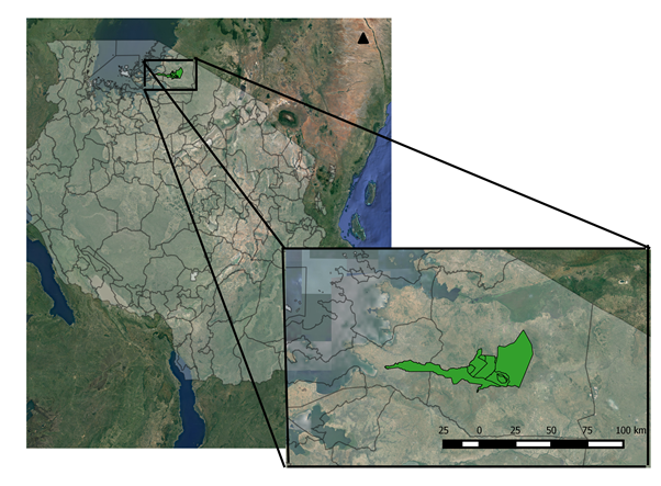
The Geospatial and Farming Systems Research Consortium (GFC), a consortium of the Feed the Future Innovation Lab for Collaborative Research on Sustainable Intensification, recognizes land resources as an integral component of the farming system framework for sustainable intensification. The GFC is supporting projects in Cambodia and Tanzania that focus on competition over land resources due to agricultural expansion and changes in cropping systems. The project in Tanzania is led by Kate Tiedeman, a graduate student in Ecology at the University of California, Davis. She is partnering with the Singita Grumeti Fund Research and Monitoring team to investigate the existing footprint of agriculture and possible intensification in the region.

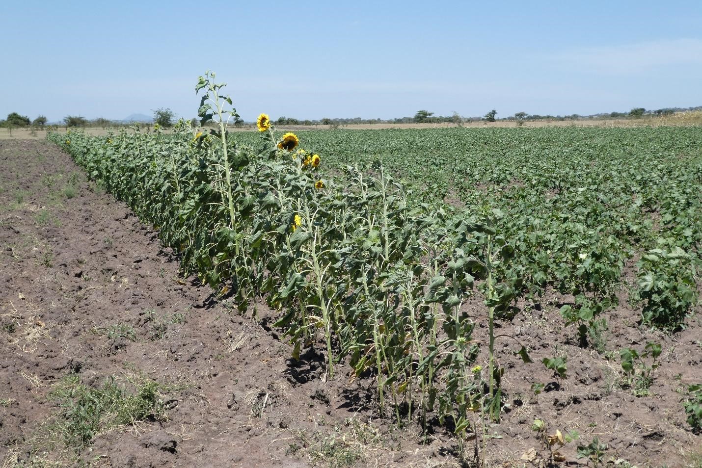
Recent estimates show 839 PAs cover around 38% of the total land area in Tanzania(UNEP-WCMC and IUCN, 2018). Tanzania has a great deal of documented population growth around PAs, as well as deforestation, agricultural expansion and increasing human-wildlife conflict (HWC). Crop damage by elephants and livestock damage caused by large carnivores disproportionately affects communities that rely on subsistence agriculture and smallholder farmers around PAs. For example, in the villages bordering the Ikorongo-Grumeti game reserve, over 80% have experienced crop raiding in 2016 (Denninger Snyder et al., 2017). Current fencing and buffer crop strategies are largely ineffective (Figures 1-3). Projections based on population growth and food consumption patterns in Tanzania indicate that agricultural production will need to increase by at least 70 percent to meet demands by 2050. In absence of significant intensification opportunities, the amount of land converted to agriculture is expected to increase to meet the production demand. Under this future scenario, there is little doubt that PAs will also face pressure from advancing agricultural frontiers. In order to retain the functionality of PAs and promote sustainable intensification of agriculture in Tanzania to ameliorate the impacts of population growth and its pressure on PAs, it is essential to understand the historical patterns and drivers of agricultural expansion.
In her research, Kate is focusing on the following questions for the Serengeti-Mara region:
- What is the history of agricultural expansion and landcover change in the region?
- What factors, such as management and population density, lead to greater agriculture expansion?
- Can specific cropping practices reduce human-wildlife conflict, specifically elephant crop raiding?
- How best can the balance between agriculture landscape and wildlife movement – retaining landscape connectivity and permeability through land use planning and cropping practices – be maintained?
In 2017, Kate conducted her first surveys to collect spatially explicit information on major landcover classes (grassland, wooded grassland, shrubland, forest, thicket, open thicket, bare, built, agriculture) and crop types (maize, millet, cotton, cassava, rice, mixed fields, and other crops) surrounding PAs in the Serengeti-Mara region of Tanzania. A repeat survey was conducted in 2018 for crop types present in the region to account for the two growing seasons. Additional surveys are planned for October 2018. The Research and Monitoring team at Grumeti Fund has been collecting spatially explicit human-wildlife conflict data in ten villages since late 2016, in addition to the government collected data for the consolation program for farmers impacted by elephant crop raiding from 2009 in Serengeti District and 2012 in Bunda District.
Kate is using cutting edge geospatial techniques, involving the analysis of time series remote sensing data collected by the National Aeronautics and Space Administration (NASA) and the European Space Agency (ESA) satellites in Google Earth Engine, which is powered by Google’s cloud infrastructure. These techniques allow her not only to study the current landscape but also to investigate the changes over historical periods, going back 20-30 years. This work advances the understanding of land use change and cropping systems, which ultimately leads to better understanding of human pressures around protected areas.
Kate has already presented preliminary findings of her research in Ecological Society of America meeting in Portland in August 2017. She will present final findings at the Foss4g conference in Dar es Salaam, TZA in August of 2018.
Authors:
Kate Tiedeman and Dr. Aniruddha (Ani) Ghosh, University of California, Davis
References:
Denninger Snyder, K., Mbise, N., Kibwe, M., Benjamin, B., Mikilindi, P., 2017. Monitoring Human-Wildlife Conflict in the Western Serengeti, in: TAWIRI Scientific Conference: 2017 December 6 – December 8. Arusha, Tanzania.
Hansen, A.J., DeFries, R., 2007. Land Use Change around Nature Reserves: Implications for Sustaining Biodiversity1. Ecol. Appl. 17, 972–973.
Juffe-Bignoli, D., Burgess, N.D., Bingham, H., Belle, E.M.S., De Lima, M.G., Deguignet, M., Bertzky, B., Milam, A.N., Martinez-Lopez, J., Lewis, E., 2014. Protected planet report 2014. UNEP-WCMC Cambridge, UK 11.
UNEP-WCMC and IUCN, 2018. Protected Planet: Protected Area Profile for United Republic of Tanzania; The World Database on Protected Areas (WDPA)/The Global Database on Protected Areas Management Effectiveness (GD-PAME)] [On-line], [May 2018].
Wittemyer, G., Elsen, P., Bean, W.T., Burton, A.C.O., Brashares, J.S., 2008. Accelerated Human Population Growth at Protected Area Edges. Science (80-.). 321, 123–126. https://doi.org/10.1126/science.1158900