Kansas State University

search

Safety Blog

Category: General

Hail and Wind Safety

As we continue our journey through Severe Weather Preparedness Week, we can now turn our attention to two of the more common hazards associated with severe thunderstorms: hail and wind.

Perhaps it would first be appropriate to define just exactly what a severe thunderstorm actually is. Much like tornadoes, the National Weather Service issues severe thunderstorm watches and warning. A Severe Thunderstorm Watch means that conditions are favorable for severe thunderstorms and that conditions should be monitored. Watches are issued over a wide area and usually before storms form.

A Severe Thunderstorm Warning means that a thunderstorm has formed that meets the criteria for being defined as severe. This means that the storm contains either damaging wind gusts in excess of 58 miles per hour or hail at least one inch in diameter or both. A warning is typically issued over a relatively small geographic area in advance of an existing storm. If a warning is issued, it is best to seek shelter in a sturdy structure, away from windows. It is also important to keep track of changing weather conditions, as severe thunderstorms can sometimes produce tornadoes with little or no advance warning.

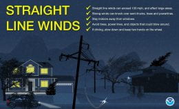
While there are minimum criteria for a thunderstorm to be considered severe, storms can produce much more extreme winds that result in widespread damage and the potential for injury. Storms can sometimes produce damaging straight-line winds in excess of 100 mph and affect much larger areas than a single tornado. A long-lasting severe weather and damaging wind event called a derecho impacted much of Iowa and the Midwest last August, resulting in billions of dollars in damage and five fatalities.

Similar to wind, the minimum criteria for hail to be considered severe belies the high-end damage that can occur from larger hailstones. The largest hailstone ever recorded in the United States was almost 8 inches in diameter and weighed nearly 2 pounds. Hailstones as big as baseballs — 2.75 inches in diameter — can fall at more than 100 mph. These types of storms can be both incredibly destructive and deadly.

With such a wide range of hazards possible within a severe thunderstorm it is important to pay attention to the specific of a warning when it is issued. Text with a severe thunderstorm warning will highlight the hazards, including an estimation of wind speed and maximum hail size that meteorologists expect with the storm. While we may be used to severe thunderstorms here in Kansas, it is imperative to stay aware of changing weather conditions and to be ready to seek shelter when a warning is issued.

Lightning Safety

Though the tendency can be to focus on tornadoes when preparing for thunderstorms, other hazards can pose just as dangerous of a threat. One of the easiest hazards to overlook is that of lightning.

Each year, lightning strikes the United States, on average, about 20 to 25 million times. While the majority of those strikes don’t cause any direct damage or long lasting consequences, the potential exists within each lightning strike to cause great harm or even death. An average of approximately 30 people die each year in the United States from lightning strikes.

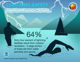
The majority of lightning deaths and injuries come from people engaged in outdoor activities — things like swimming, golfing, fishing, or hiking. It is important to remember that there is no safe space outside from lightning — the only secure location is an enclosed building or in a vehicle.

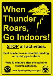
It may not always be easy to tell how close you are to a storm and if you are within the threat area for a potential lightning strike. A good rule of thumb is that, if you can hear thunder, then you are close enough to a storm to be impacted by lightning, and you should seek appropriate shelter. Sometimes, however, especially as storms are first forming, you may not have any advance warning before lightning impacts your area. If skies appear threatening, it may be safest to pro-actively seek shelter.

If someone has been struck by lightning, they need immediate medical attention. Call 911 for rapid medical response. If it is safe to do so, move the victim to a safe location inside, away from the threat of another lightning strike or other hazards. Lightning often causes the heart to stop, so administering CPR may be needed until help arrives.

More information about lightning safety is provided by the National Weather Service.

Winter break safety tips

It’s almost time to breathe a big sigh of relief with the completion of finals and the fall semester, but it is not time to let down your guard.

According to area law enforcement agencies, areas with high densities of student housing are often targeted by criminals during breaks in the academic calendar because a majority of residents are out of town.

Regardless of where you might be spending winter break, please be vigilant and aware of your surroundings. Kansas State University Police and Riley County Police Department share these safety tips:


Residential safety

  • Keep doors and windows closed and locked.
  • Install good quality locks on doors and windows. Deadbolt door locks are always best.
  • Sliding glass patio doors are frequent points of entry for burglars. They should always be reinforced by wedging a stick or pole firmly in the lower track behind the door.
  • Unplug your automatic overhead garage door opener when leaving for an extended period of time.
  • Install peepholes in doors.
  • Keep shrubbery trimmed so doors and windows are not obscured.
  • Ask reliable neighbors to watch your residence when you are away. Keep newspapers, handbills, and mail picked-up while you are gone.
  • Keep valuables well hidden especially checkbooks and extra checks. Record and safely store serial numbers from valuable items, such as electronics and firearms.
  • Keep premises well lit at night.
  • Never let strangers into your home, not even to use the phone.
  • Never give information indicating when you will or will not be at home to those you don’t know or through social media.
  • Never let strangers know if you live alone.
  • If you are gone overnight, use automatic timers on interior lights to give the appearance that the residence is occupied.


Personal safety

  • Be aware of your surroundings.
  • Never open your door to strangers; require ID of service or repair people.
  • Plan several escape routes from your home.
  • Park in well-lit areas and lock your vehicle.
  • If you come home and something looks wrong or different — do not enter, go to a safe place and call police.
  • Keep money in a pocket instead of a purse or wallet.
  • Portray a confident and self-reliant person, walk like you have a mission.
  • Do not walk or jog alone at night.
  • If someone makes you feel uncomfortable or the situation just does not seem right, trust your instincts and leave.
  • Avoid excessive alcohol consumption.
  • If you are attacked or robbed, or you witness violence, be a good witness and contact the police immediately.
  • Immediately report anyone seen watching people or acting suspicious.

Be prepared for winter weather

The National Weather Service is predicting a storm system that may bring wintery precipitation to the central U.S. Wednesday, Oct. 30, and Thursday, Oct. 31. The following tips will help you stay safe this winter.

Safety while driving 

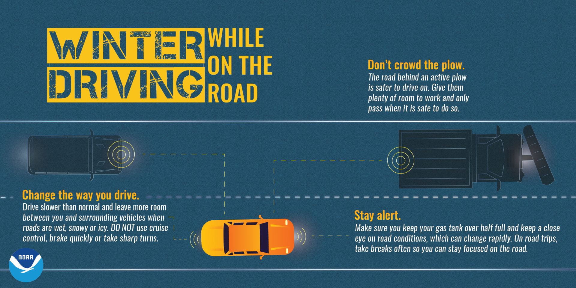
The biggest weather hazard in Kansas is icy roads, so you need to be prepared when traveling during the winter as well. The best way to counter this hazard is slow down. You want to do everything slower and lighter than you normally would. Hitting your gas pedal, slamming your brakes or cranking your wheel too quickly is a surefire way to lose traction on an icy or wet road.


Plan ahead

A little planning goes a long way. Be sure to check the weather forecast along your trip by visiting weather.gov. Visit the Kansas Department of Transportation website to access information about your road conditions including webcams.


Stock your car emergency kit

An emergency kit is essential in case you become stranded. Check out this list of emergency supplies to make your own car emergency kit.


Additional tips

For winter safety tips, visit the National Weather Service Winter Weather Safety Page.

Safety training courses offered at K-State

Emergency preparedness is the shared responsibility of all campus and community members. K-State offers the following training opportunities to help prepare individuals for potential emergency situations.

ALICE training

Offered by the K-State Police Department ALICE, which stands for Alert, Lockdown, Inform, Counter, Evacuate, training teaches participants what to do in the event of a violent intruder situation. ALICE is an options based response that allows people in a crisis situation to use the information they have to take proactive steps to save their lives. Open enrollment ALICE training sessions are offered regularly on campus or can be scheduled for a class, group, or department. Trainings are posted in HRIS when available. K-Staters can also watch a short video that highlights the ALICE strategies on the ALICE trainingpage. For more information on scheduling ALICE training contact Sgt. Chad Jager with the K-State Police Department at 785-532-1132 or cwj7667@k-state.edu.

Stop the Bleed training

No matter how rapid the arrival of professional emergency responders, bystanders will always be first on the scene. A person who is bleeding can die from blood loss within five minutes, therefore it is important to quickly stop the blood loss. Those nearest to someone with life threatening injuries are best positioned to provide first care. According to a recent National Academies of Science study, trauma is the leading cause of death for Americans under age 46. Stop the Bleed training teaches proper bleeding control techniques, including how to use your hands, dressings and tourniquets to save someone’s life or your own. The K-State Police Department regularly offers open enrollment classes on campus. Trainings are posted in HRIS when available. Stop the Bleed training can also be scheduled for specific groups or departments. Contact Sgt. Chad Jager with the K-State Police Department at 785-532-1132 or cwj7667@k-state.edu for more information on Stop the Bleed training.

K-State also has co-located at least one bleeding control kit with each publicly available automated external defibrillator on campus. You can locate AEDs via the safety map in the LiveSafe app.

First Aid training

The Lafene Health Center offers first aid certification to K-State students, faculty, staff and the public through the American Heart Association. See the Lafene Health Center CPR page for details on registration, fees and scheduled skill testing sessions.

Extreme heat

Heat is one the leading causes of weather-related deaths and injuries in the United States. Excessive heat causes hundreds of deaths every year. Heat can affect people in a variety of settings and while dangerous heat is associated with the summer season, it can occur in the spring and fall as well.

The risk

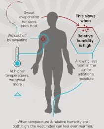
When exposed to high temperatures your body sweats, which evaporates to cool your body. Hot and humid weather challenges your body’s ability to cool itself because your body sweats a great deal to try to maintain your body temperature. Over time this increased sweating leads to dehydration and your body temperature becomes elevated. Increased levels of humidity make this worse as the high water content of the air hampers the evaporation of sweat on your skin. This can result in heat exhaustion or heat stroke. Those most at risk for heat illness include infants, children, the elderly, overweight people and those who are ill or have certain medical conditions such as high blood pressure.

Heat exhaustion

Heat exhaustion is a mild form of heat illness that may develop after days of exposure to high temperatures and inadequate fluid intake. If not treated, heat exhaustion may become heat stroke. A person suffering from heat exhaustion may have cool moist skin. Their pulse rate will be fast and weak and their breathing will be fast and shallow. Additional warning signs of heat exhaustion include:

  • Heavy sweating
  • Paleness
  • Muscle cramps
  • Tiredness
  • Weakness
  • Dizziness
  • Headache
  • Nausea or vomiting
  • Fainting

Heat exhaustion first aid

  • Drink cool beverages without alcohol or caffeine.
  • Move to an air-conditioned environment.
  • Take a cool shower, bath or apply cold compresses.
  • Rest

Heat stroke

Heat stroke is the most serious of heat-related illnesses. It occurs when the body is unable to cool itself because the ability to sweat fails. A victim’s body temperature will rapidly rise within a few minutes. Heat stroke can cause death or permanent injury if it is not treated quickly. Warning signs of heat stroke vary but can include:

  • An extremely high body temperature — above 103 degrees Fahrenheit.
  • Red, hot and dry skin without sweating.
  • Rapid, strong pulse.
  • Throbbing headache.
  • Dizziness.
  • Nausea.
  • Confusion.
  • Unconsciousness.

Heat stroke first aid

  • Call 911 immediately. Untreated heat stroke may result in death or disability.
  • Move the victim to a shady and/or air-conditioned area.
  • Cool the victim rapidly using whatever means available such as a cool shower or bath, garden hose, or sponging with cool water.

Prevention

Like many hazards there are steps you can take to avoid becoming a victim of heat illnesses.

  • Drink lots of water and avoid alcohol and caffeine.
  • Limit strenuous outdoor activities.
  • Wear light colored, light weight clothing.
  • Use sunscreen.
  • Take breaks in the shade as often as possible.
  • If working in the heat, increase workloads gradually. Allow new employees and workers who have been off for more than a week more frequent breaks.
  • Change your schedule so outdoor work is performed early or very late in the day.
  • NEVER leave kids or pets in vehicles.
  • Check on the elderly, sick and those without air conditioning.
  • Be aware of the symptoms of heat illness and take action if you see someone at risk.

Sources

Tornado warnings and K-State Alerts

Many K-Staters have asked why a K-State Alerts message was not sent when the tornado warning was issued on May 21.

Currently, K-State Alerts are only issued for tornadoes if the campus falls within the warning area designated by the National Weather Service. The May 21 tornado warning was for areas to the west and north of Manhattan so the campus was not directly at risk. The outdoor warning sirens for the cities of Ogden and Manhattan are tied together. So when the sirens were sounded to warn the people in Ogden of the tornado, the sirens in Manhattan activated as well. This is why a K-State Alert wasn’t issued even though the Manhattan sirens were activated.

If you’re ever in doubt, it’s best to err on the side of safety and take shelter.

K-State Alerts: What we can learn from the May 9 incident

Following the shots fired incident on May 9 at the KSU Foundation, K-Staters have asked for information about what they should do if a similar incident happens in the future. As is true in many situations, we can learn from our experiences and apply the lessons to be better in the future.

Preparation is a tremendous asset in a crisis.
K-State Police and the university’s crisis communications team practice and meet regularly to prepare for potential crises but all K-Staters need to make safety a top priority. As a member of the university community there are steps you can take to be informed and prepared.

Sign up for text alerts through K-State Connect. While K-State Alerts are delivered to all university emails, you must intentionally sign up to receive text alerts. Many who asked why they did not receive an alert on May 9, had not signed up for the text message option.  Receiving alerts through text messages is a personal safety feature that is strongly encouraged. Texts are the fastest method the university has to deliver emergency messages, as email delivery can sometimes be delayed. Please opt in for text alerts!

Take an ALICE training. The next scheduled training is May 22 and you can sign up through HRIS. Also, trainings can be scheduled for entire departments by contacting Sergeant Chad Jager at cwj7667@k-state.edu or 785-532-6412.

Familiarize yourself with your departmental or building’s emergency plan. If there isn’t one, help to make one — emergency plan templates are available under the Planning Resources bullet on the emergency management website. If multiple departments are in the same building, they must plan and train together. For emergency planning guidance, contact Michael Bear, emergency management coordinator, at kstateem@k-state.edu or 785-532-6412.

The K-State Alerts system, ALICE training and emergency plans work.
On May 9, most people followed instructions in the K-State Alerts message and stayed clear of the area. This allowed police to conduct the investigation and if there had been injuries, it would have given emergency medical personnel room to do their jobs.

Although the police did not issue a lockdown, some buildings relied on their departmental or building safety procedures and locked the doors. The Rec Center and the College of Veterinary Medicine evaluated their proximity to the incident and followed their protocols. This doesn’t mean they overreacted or that other parts of campus underreacted. Each person and department will encounter different circumstances and must adjust accordingly — as the ALICE training teaches.

Brief facts are the most effective in emergencies.
K-State Alerts provides short and direct messaging through text messages (if you are opted in), email, alert beacons, the website, social media and possibly a loud speaker. The messages are designed to give basic information in as few characters as possible so K-Staters can quickly read and implement safety plans.

K-State Police took several factors into account about what language to use for the first May 9 alert. For example, the term “shots fired” was used because there were no reports of a person being hurt. In the short, quick messages — limited to 160 characters —facts are prioritized over explicit instructions, grammar, spelling and punctuation. During an incident, we’d like to provide complete, detailed and politely-worded information and instructions to everyone, but it is not possible in the middle of an emergency.

Wall-mounted beacons are for initial alerts but other media should be used for updates.
The alert beacons in various campus buildings will sound for several minutes. An incident might still be ongoing even if the beacon stops sounding. Changes in incident status will be sent as separate messages in K-State Alerts, official university social media posts and website homepage notices and may re-trigger the beacons, but in some cases it may not. The beacons are installed and maintained by Network and Telecommunications Services.

Loved ones and visitors may want to receive K-State Alerts, too.
Several parents and students were confused because they did not receive a text message about the situation. K-Staters can add up to three phone numbers and e-mails to three different addresses to their account. This is a good way to include family members in notifications if desired. Non-affiliated K-State visitors and community members can receive alerts for all three campuses by texting KSTATEVISITOR to 67283.

Please remember, you’ll only receive K-State Alerts by text message if you opt-in via K-State Connect. Also, alerts settings default to coverage for all three campuses. You can change this setting in K-State Connect. Read how.

The K-State Alerts policy was revised to only announce emergencies and campus closures.
Through surveys and feedback forms, we’ve also learned that many people who were initially enrolled in K-State Alerts text messages unsubscribed because alerts regarding thunderstorm watches and other weather events not requiring action became intrusive. The K-State Alerts policy was revised several years ago and weather alerts are now only issued for severe weather events affecting university property, campus closures and serious safety issues. Please re-enroll for the most direct means of all types of emergency notices.

The K-State Police work to make campus as safe as possible, but every member of the K-State community can contribute to this effort. Whether it is by enrolling for K-State Alert texts, taking ALICE or Stop the Bleed training, reporting suspicious activity via the LiveSafe app, or participating in emergency planning and training, your actions help make K-State a more prepared and resilient place for us all to live, learn and work.

K-State Alerts tips

With many notifications coming to cellphones, it can be difficult to know which are worth looking at and which need immediate action. To ensure you’re aware of K-State Alerts, consider the following:

Set custom notification sounds

Smart phones allow you to set custom ring tones for calls and texts from specific numbers. By setting specific sounds for K-State Alerts, you’ll know when it’s a critical communication versus spam.

Custom vibrations

In a meeting or class with your ringer muted, you won’t know which buzz is critical. Some smart phones allow you to set custom vibration patterns as well as ring tones. Give K-State Alerts a custom pattern so you’ll recognize the urgency.

Do not disturb/silent mode

Many people set their phones to silent or do not disturb mode to have a good night’s rest. To ensure you get K-State Alerts at all times of the day or night set K-State Alerts up to bypass your Do Not Disturb setting.

Adjusting these options will vary from phone to phone but the majority of the time they can be found in your settings or contact menus. Whatever kind of smartphone you have you should add the K-State Alerts numbers to your phone. These numbers are:

Phone Text Text Text Text Text
785-532-0111 67283 226787 78015 81437 77295

Remember, you’ll only receive K-State Alerts via text if you have opted-in. You can double check in K-State Connect.

If you have any questions or concerns regarding K-State Alerts, contact Michael Bear, emergency management coordinator, at kstateem@k-state.edu or 785-532-6412.

Severe thunderstorms and tornados

People typically associate severe thunderstorms capable of producing tornadoes, dangerous lightning and heavy rains with the spring and summer, but in fact, these storms can happen during any season at any time of day.

One of the best ways to prepare for a severe thunderstorm is to have a properly programmed NOAA weather radio. These radios broadcast continuous weather information from the nearest National Weather Service office and broadcast official warnings, watches, forecasts and other hazard information 24 hours a day, seven days a week. NOAA weather radios are readily available at local stores or online retailers. In addition to weather radios, there are numerous smartphone apps that can let you know a severe storm is approaching.

During severe storms or tornados, Riley County and K-State use outdoor warning sirens to alert those outside of the need to take cover. The K-State Alerts system will be utilized to inform those in on-campus buildings of a tornado threat. Warnings also will be transmitted via local broadcast media.

When you hear a severe thunderstorm warning seek shelter immediately. Some buildings have designated shelter areas whose locations are posted in public areas or detailed in the building emergency plan. If you are inside a building without a designated shelter area, go to the lowest floor close to the core of the building. Stay away from windows and avoid larger open areas such as cafeterias, gyms, or auditoriums.

If you are outside you should seek shelter inside a sturdy building. DO NOT shelter in sheds, storage buildings or under trees. Sheltering in a vehicle is safer than being outside, but if there is time you should drive to the closest shelter.

For more information go to the K-State Emergency Guide

Flooding safety, resources

In light of the flooding that occurred in Manhattan last Labor Day and in Nebraska earlier this year, many K-Staters have expressed concerns about flooding both on and off campus.

All three campuses are fortunate to be outside of floodplains. However, during heavy rain, water drainage for the Manhattan campus via Campus Creek is sometimes unable to keep up, resulting in roadway flooding near campus and minor water intrusion into some campus buildings. The roads typically affected are North Manhattan where it intersects Petticoat Lane, Campus Creek Road, Lovers Lane, Vattier Street and Anderson Avenue. K-State police monitor the water level in Campus Creek and the nearby roads. If flooding is in progress they block off these areas as quickly as possible.

If you encounter flooded roadways or sidewalks, NEVER walk or drive into flood waters. Six inches of fast moving water can knock over and carry away an adult. Twelve inches of fast moving water can carry off a small car. Eighteen to 24 inches of water can carry away most large SUVs, trucks and vans. Water is usually deeper than it appears. Even if your car is not carried away, driving into flood waters can damage the engine. It’s best to remember the National Weather Service’s advice when you encounter a flooded area: Turn Around, Don’t Drown.

For K-Staters living off campus it’s best to do some research before buying or renting. Certain areas of Manhattan, Salina, and Olathe are more prone to flooding than others. All three of these cities provide floodplain maps and other resources that identify areas at risk from flooding. The majority of renter and home insurance policies do not cover flood damages. If you choose to live in a flood prone area, seek out additional flood insurance to offset your potential losses.

Visit the K-State Emergency Guide for links to flooding resources.

Welcome to the K-State Safety Blog

The Kansas State University Police Department and emergency management team are collaborating to bring the university community safety information through monthly blog posts. While different topics will be shared each month, additional information will be posted as needed.

View safety resources on the Emergency Guide.

Contact the K-State Police Department at 785-532-6412 with questions.