Kansas State University

search

IT News

Tag: Google maps

K-State sidewalk views included in huge Google Maps Street View update

photo of Hale Library on the Manhattan campus at Kansas State University
Hale Library's south elevation as shown in the Oct. 11 update of Google Maps Street View

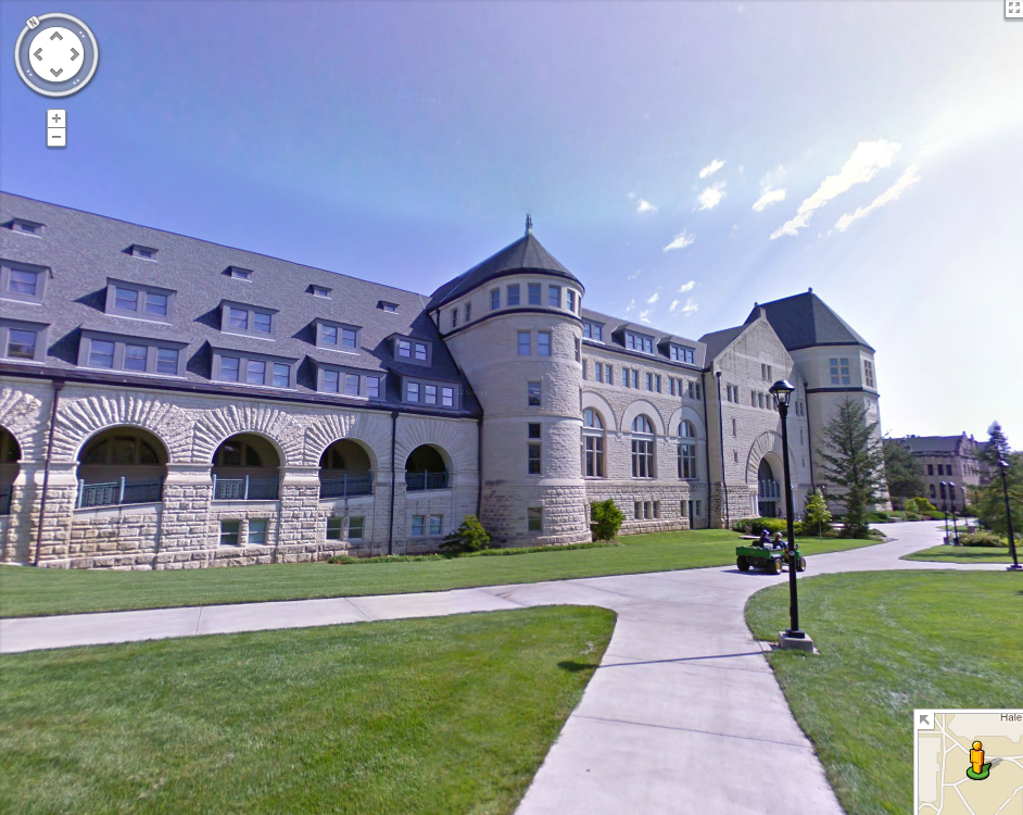
During the week of Aug. 19, Google Maps Street View was on campus taking pictures from K-State sidewalks.  On Oct. 11, Google released its largest StreetView update ever, with 250,000 miles of new and updated roads.  This large update includes the Street View pictures taken in August from sidewalks across K-State’s campus.  Continue reading “K-State sidewalk views included in huge Google Maps Street View update”

Google Maps Street View team photographing campus

A Google team is on the Manhattan campus this week to capture Kansas State University for the interactive Internet experience Google Maps with Street View. The feature lets users explore places around the world through 360-degree street-level imagery.

Continue reading “Google Maps Street View team photographing campus”

Using Gmaps Pedometer for a tech-enhanced walk/jog/cycle around campus

The Pedometer tool in Google Maps combines cool mapping features with a digital pedometer in order to help walkers, runners, and cyclists track their distance. This tool is found at www.gmap-pedometer.com. Its homepage offers a pedometer feature to the left and a U.S. map to the right.

Google map pedometer entry view

Continue reading “Using Gmaps Pedometer for a tech-enhanced walk/jog/cycle around campus”